
About the Writer

Andrew McLaughlin, News Editor
Andrew McLaughlin is a ninth-grader at North Allegheny Intermediate. He formerly was the editor on the student newspaper at Carson Middle School and enjoys...
NAEye profiles some of the many stories that form our local heritage, from North Park to whom Perry Highway is named after.
February 21, 2020
Too often, residents of a local area have neglected to be aware of the history of their surroundings. Since that person lives in that place, then the frequent idea is that he or she would be an expert on its history by default. That is often true in regards to current events that occur locally, but there are also more anecdotal details that may be less significant but are always no less interesting. The area containing North Allegheny has its own share of local history that has connections to both national and regional events. Driving down Perry Highway, the significance of the name of the route is unlikely to cross one’s mind; furthermore, there have been various other historical events of note that have left less visible reminders in our local area. Whether you are aware of it or not, you are surrounded by history in the North Hills of Pittsburgh everywhere you go.
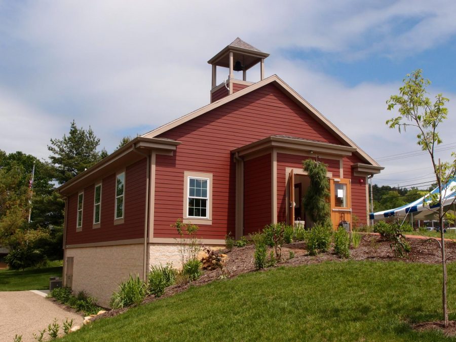
Before settlers came to our area, Native Americans inhabited the area. The Delawares – members of the Iroquois Nation – inhabited the area surrounding Pittsburgh, and although little is known about their specific history in the North Hills, they were the ones who first lived in the area that we now call home. The Delawares would be ousted by colonial settlement in 1794. Following the Revolutionary War, soldiers were paid in continental script, the currency of the period. However, the script had depreciated, or decreased in value due to inflation, so the soldiers had the option of receiving tracts of seized Native American land – which led to the aforementioned settlement issues – through the use of certificates that could be traded in for cash or land at a later date. Today, the Depreciation Lands Museum in Hampton Township relives that era in the spring and summer months.
Going back more than 200 years, we find that one of the earliest visitors to our community was none other than George Washington. Washington, along with his guide, Christopher Gist, passed through McCandless in December of 1753 on the Venango Trail – near Pine Creek in McCandless – beginning a cold trek back to Virginia on their return from a famous meeting with the French Commander of Fort Le Boeuf, which is near Erie today. Why was George Washington tromping through the North Hills of Pittsburgh at 21 years old? The answer lies in the tensions over the Forks of the Ohio that were escalating at the time; Washington had been sent to Western Pennsylvania by Virginia governor Robert Dinwiddie with the task to request that the French remove themselves from the area. This was due to their assertion of themselves as the dominant force of the region, which of course was prized for its advantages in both transportation and military. The French refused to leave, and tensions would further escalate with the building of Fort Duquesne the next year, which coincides with the beginning of the French and Indian War. Such a footnote in our community’s history is one of the oldest events of note of the area, but it is one that holds ties to national history.
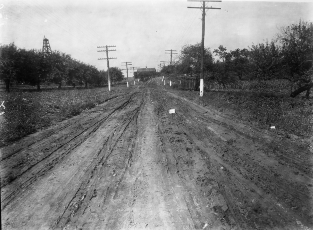
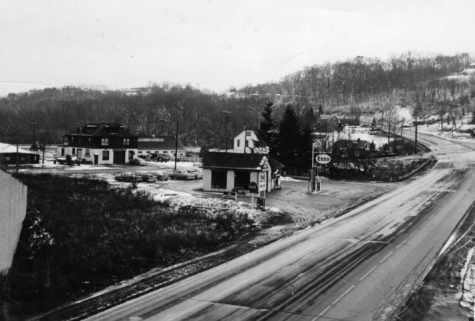
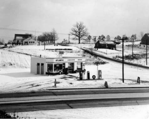
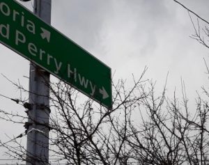
Perry Highway – also known as U.S. Route 19 in our area, was the site of another famous visitor to McCandless. Commodore Oliver Hazard Perry gained prominence in the defeat of the British at the Battle of Lake Erie in 1813, one of the principal American naval victories of the War of 1812. To reach Lake Erie from the factories of Pittsburgh, Perry’s Overland Route reached north, including through McCandless, primarily through the use of the old Venango Trail. Even today, this route can be seen in the alignments of road marked “Old Perry Highway” that sometimes split off from Route 19 – these winding byways were a key factor that Perry utilized to help secure his victory. A dirt route at the time, Perry’s Overland Route would be modernized with a covering of wooden planks in 1849. Perry Highway completed its conversion into a concrete surface in 1929.
Another aspect of the history of Perry Highway involves the salt trade, which was important in the time before refrigeration when it was necessitated for preventing food spoilage. However, the fact that we drive on the spiritual descendant of a crucial supply route that played a part in securing an American victory during the War of 1812 practically every day is a fascinating fact that many residents are likely unaware of.
The seal of the Town of McCandless is something that everyone who lives in the immediate area surrounding our school is at least subconsciously aware of – after all, it’s placed on all of the garbage cans in the town. If you take a look at the seal, however, you’ll find images of two things that couldn’t be more foreign to McCandless today: an oil well and a trolley. Both hold interesting backstories. In 1900 oil was discovered to be plentiful in McCandless, and oil wells started to quickly pop up around the community to take advantage of this resource. At the peak of the town’s oil “boom” in 1916, more than 150 oil wells located in McCandless.
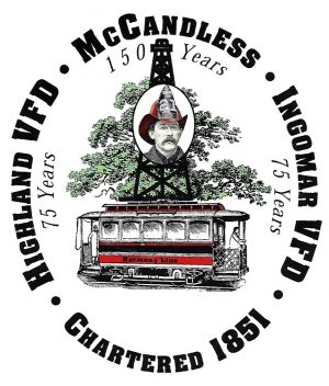
With the advent of large industrial conglomerates and the decrease in small oil operations, the Town’s oil wells would decline soon after that peak, although a select few have remained in production up through the present. To transport oil to locations north of McCandless, an underground pipeline was built, but there was also another convenient method…
The trolley on the seal is another storied component of local history that played a key part in the development of McCandless and the North Hills as a whole. Although it was used to haul drilling supplies to the area, the Pittsburgh, Harmony, Butler and New Castle Railway – commonly known as the Harmony Line – was more heavily utilized to move people. Built in 1908 by a North Side department store owner hoping to drive traffic to his store from areas north of Pittsburgh, the Line was revolutionary in the sense that it allowed for the development of many new “bedroom communities” along its route between Pittsburgh and Butler/New Castle that had previously remained underdeveloped because they had not had a connection to a large population center. In addition to a more accessible line to downtown, the Harmony Line also shipped mail and coal.
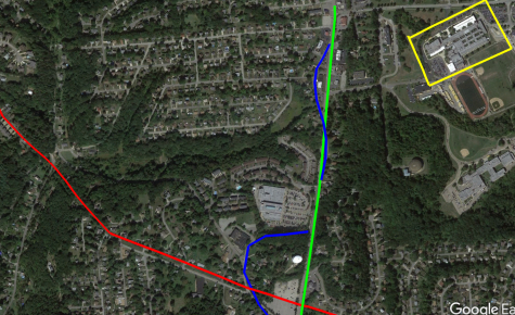
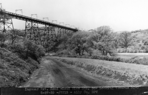
With the invention of the affordable Model T – combined with the lowering of bus fares – the Harmony Line carried its last passengers in August of 1931. However, much of its old alignment can still be seen in the local area today. Any road named “Harmony” – such as “Harmony Drive” and “Harmony Parkway” – was built on the old trolley line. The Harmony Trail, which encompasses the Rachel Carson Trail today, is another alignment that can still be traveled. Some of the old paths are now wooded, but the entire Harmony Line can still mostly be followed on a satellite mapping website. Looking at a map will also allow insights into how the distinctive topography of the region was covered. For instance, there was once a large bridge that spanned today’s Sloop Road.
North Park represents 14.2% of the total area of the Town of McCandless, and it was built as a result of the effects of Franklin Delano Roosevelt’s New Deal program that attempted to lower unemployment in response to the Great Depression. In the case of North Park, the Civilian Conservation Corps – the first program of the New Deal – laid the groundwork for the park of today by planting trees and constructing picnic pavilions across the park’s 3,000 acres, among other things. It is important to note that when the county purchased the land for North Park, it was mostly barren of growth, quite a contrast to today’s lush greenery. It was only through the efforts of the CCC that North Park was provided with a tree cover that, 80 years later, has grown into a canopy. Later, other New Deal programs, including the Works Progress Administration and Public Works Administration, wouldld be instrumental in building park landmarks like the Boathouse, Swimming Pool, and Lodge. North Park’s man-made lake was also built at this time. Today, most area residents take advantage of North Park to some extent, but the interesting component it played in the New Deal era is a textbook example of the American spirit that was played in similar places all across our nation.
In an examination of the transportation heritage of the North Hills, we would be remiss not to mention McKnight Road. Construction started in 1939 on land partially owned by a man named John McKnight. At the time, the road was a two-lane farmer path – quite a contrast from today’s bustling throughway! McKnight Road construction was started by the Works Progress Administration, but due to World War II, construction was halted until work could resume in 1947. McKnight Road would finally open in 1954, providing a modern link to the city to the rapidly growing population of the North Hills. Completed by the county, the original purpose of the road was to link North Park with the rest of Pittsburgh, which is why ramps connect directly to Ingomar Road, one of the gateways to North Park. This was also the road’s original northern terminus. Along McKnight Road, you can find Northway Mall, which is known today as the “Block at Northway.” However, when it was enclosed in 1962, this was the first indoor shopping mall in Pennsylvania, although it had been originally built as a more traditional outdoor shopping plaza in 1953. At the time of its completion, Northway Mall also featured the nation’s 3rd glass elevator! Another fun fact can be found in that one of the McDonald’s restaurants along the route was the birthplace none other than the Big Mac in 1968. One of the most influential sandwiches of all time was invented just a short distance from our school!
Local history is often overlooked, but it is always full of stories that are notable to the immediate surroundings and sometimes are even pivotal in the greater story of America. In the North Hills, we have connections to the industrial center that was Pittsburgh in the early 1900s in the form of our past popularization of oil wells and the Harmony trolley line. Perry Highway played an important part in the War of 1812, and North Park provided work for men following the Great Depression. The McCandless-Northern Allegheny Heritage Center was opened in 2017 after years of development and is an interesting place to visit for those that want to learn more about the history of the North Hills. In addition, Northland Public Library includes a local history website that has numerous pictures of many North Hills communities. History may seem like something that is a distant part of our past, but local history always provides relevant examples that affect our lives today.
NAEye thanks Northland Librarian Amy Steele for her assistance with this story.
Andrew McLaughlin is a ninth-grader at North Allegheny Intermediate. He formerly was the editor on the student newspaper at Carson Middle School and enjoys...